TechonologyLeica RTC360
Field Technology.
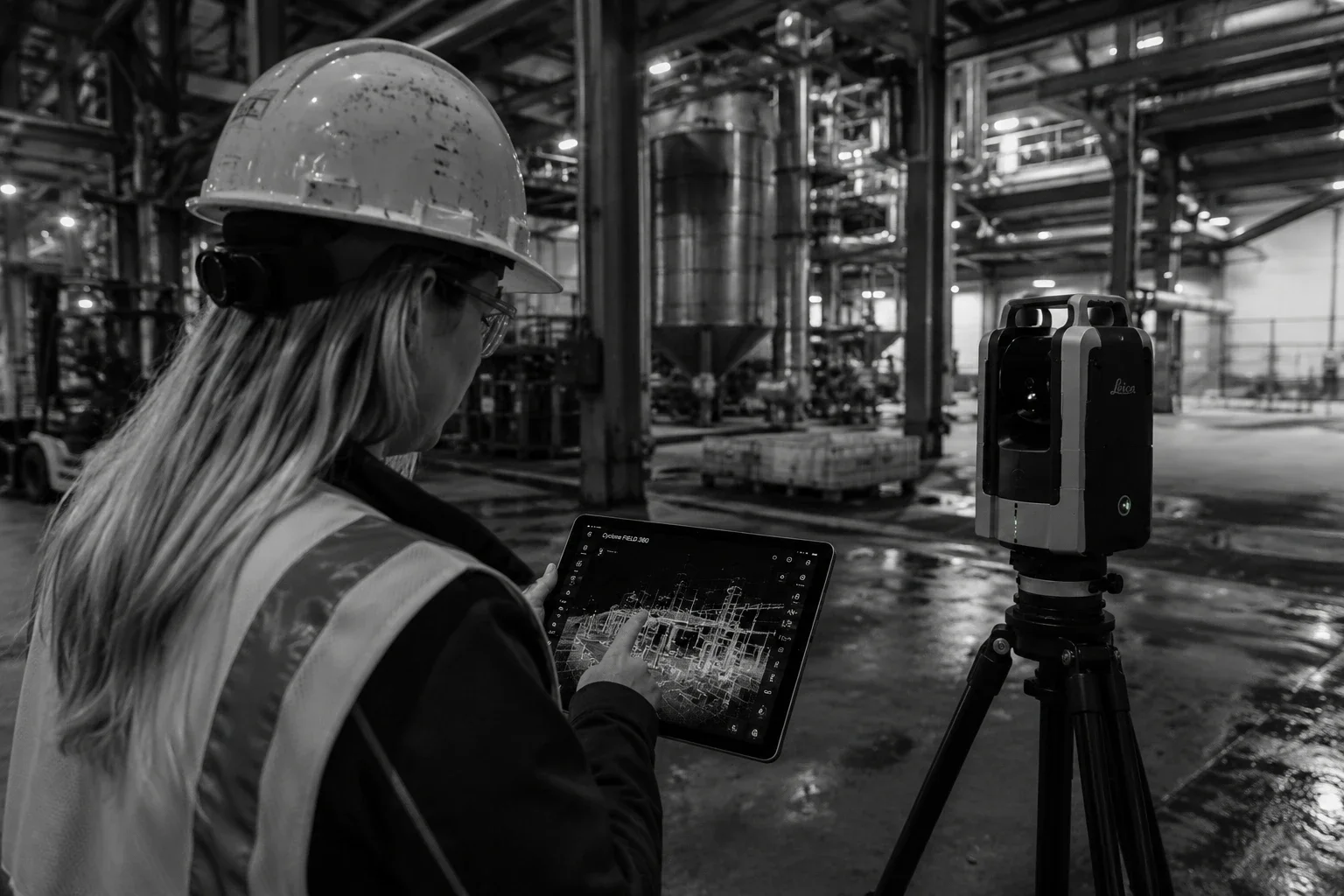
MW Site captures existing conditions using the Leica RTC360, a high-performance terrestrial laser scanner built for fast, accurate, and dependable 3D documentation in demanding field environments.
MEASUREING RATE
2M/s
POINTS
SCAN TIME
< 2 min
FULL DOM HDR
RANGE
130m
MAX
SpecificationsThe instrument we trust on every site.
Below are the field-relevant specifications we work to. For complete manufacturer details, see the official Leica Geosystems RTC360 product page.
Performance
Specification
Measuring rate
Scan time
Range
Field of view
Registration
Resolution
settings
Laser Class
values
Up to 2,000,000 points per second
Under 2 minutes for full dome scan with HDR imagery at 6 mm @ 10 m resolution
0.5 m to 130 m
360° horizontal / 300° vertical
Real-time, targetless alignment
via VIS technology
3 mm, 6 mm, 12 mm
at 10 m
1 (IEC 60825-1:2014), 1550 nm invisible
3D Point Accuracy
Distance
10 m
20 m
40 m
3D Point Accuracy
1.9 mm
2.9 mm
5.3 mm
Range Noise
Distance
10 m
20 m
Range Noise
0.4 mm
0.5 mm
Additional Accuracy
Specification
Value
Angular
accuracy
18”
Range accuracy
1.0 mm + 10 ppm
Imaging
Specification
HDR image
capture
Value
Camera system
36 MP — 3-camera system
432 megapixels of raw data per scan
Coverage
Calibrated 360° × 300° spherical imagery
Capture time
Approximately 1 minute